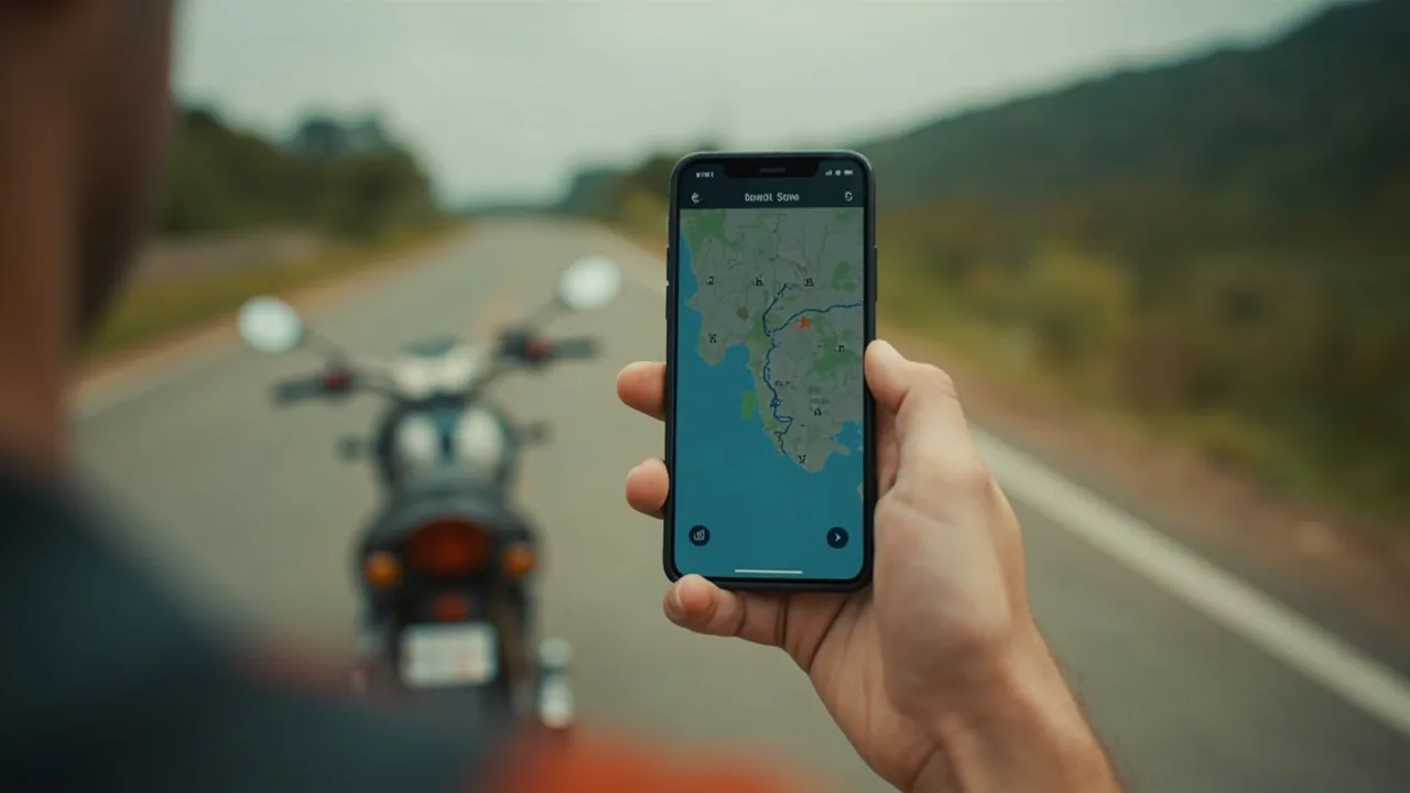
Best Offline Maps for Southeast Asia Backpacking (Tested on the Road)
Data in Southeast Asia is patchy. You will lose signal on a sleeper bus between Hanoi and Sapa, on a motorbike loop around Pai, and inside every temple complex from Angkor Wat to the Grand Palace. The offline map you pick before you fly decides whether that lost signal is a minor inconvenience or a wasted afternoon walking in circles. I have spent enough days in SEA watching travellers hold their phones up to the sky waiting for a blue dot to appear to know which apps deliver, and which ones eat your storage and lie about the road names. For related planning, see our guide on Sea Backpacking Hub.
This guide covers the three offline map apps worth installing before your flight, what each one does well, where each one falls apart, and how to set them up so the next time your bus drops you at a random junction in northern Laos, you can find your guesthouse without flagging down three different tuk-tuk drivers.
Subodh’s Pro Tip: Download two offline map apps, not one. If Maps.me glitches on a hiking trail, OsmAnd gets you home. If Google Maps can’t find the road in rural Cambodia, Maps.me still has the footpath. Redundancy costs 400 MB of phone storage, which is cheaper than one missed bus.
Quick Answers
| What | Answer | Price (INR) |
|---|---|---|
| Best overall offline map for SEA | Maps.me (free, OpenStreetMap-based, smallest download size) | Free |
| Best for navigation with a route | Google Maps offline (works for driving, weaker for walking in SEA) | Free |
| Best for motorbike and hiking | OsmAnd (turn-by-turn navigation, contour lines, tracks local road names) | Free (premium: ₹830 (~$8.62)) |
| Best free map source | OpenStreetMap data (powers Maps.me and OsmAnd, community-maintained) | Free |
| Storage needed for all four SEA countries | Roughly 1.2 GB for Maps.me, 1.8 GB for OsmAnd with contour lines | Free storage |
Safety Alert: Even the best offline map will not save you if your phone dies on a remote motorbike loop. Carry a reliable power bank and a paper backup of your accommodation address written in the local script (especially in Laos and Cambodia where English transliteration is inconsistent).
Why You Need More Than One Offline Map App
SEA breaks Google Maps. The mapping is decent in Bangkok, Singapore, and Kuala Lumpur, and the moment you cross a border or leave the city ring road, the coverage thins out. Walking paths in Pai, the scooter loops around Vang Vieng, the rural bus stops between Siem Reap and Battambang, the Mekong River islands in Laos, none of these are mapped to Google’s standard. OpenStreetMap, which is the data layer under Maps.me and OsmAnd, has thousands of local contributors in SEA who add footpaths, motorbike shortcuts, and rural bus stops that Google’s satellite-only teams miss.
The catch: OpenStreetMap data is only as good as the last local contributor who bothered to update it. Streets get renamed, roads get rerouted, and small villages disappear from the map entirely. That is why you run two apps, not one. When one fails, you open the other and triangulate.
App 1: Maps.me (Best Overall)
Maps.me is the offline map app most SEA backpackers already have, and for good reason. The free version uses OpenStreetMap data, the download size for all four main SEA countries (Thailand, Vietnam, Laos, Cambodia) is roughly 1.2 GB combined, the search function works in Latin script for most major POIs, and the routing engine handles walking, driving, and a usable if slightly aggressive motorbike profile.
What Maps.me Does Well
- Download size. The Thailand map is around 280 MB, Vietnam around 320 MB, Laos around 110 MB (the smallest because the country is sparsely mapped), and Cambodia around 180 MB. Total storage hit for the four main countries: about 1.2 GB. Compared to Google Maps offline regions, which balloon past 500 MB for a single country, Maps.me wins on storage.
- Footpath routing. Maps.me picks up walking trails that Google ignores. The Doi Suthep pilgrimage trail in Chiang Mai, the Phong Nha karst paths in Vietnam, the Mount Bromo crater rim in Indonesia, all of these route correctly when Google insists you walk along the highway.
- Bus stop and ferry pier locations. Travellers report that rural bus stops in northern Vietnam and Lao boat piers on the Mekong are tagged in OpenStreetMap long before they appear on Google.
- Offline search. Type “wat” into Maps.me in Thailand and you get every temple within 50 km, sorted by distance. The same query on Google Maps offline returns mostly sponsored results.
Where Maps.me Falls Apart
- No live traffic, no live bus ETAs. Once you lose data, Maps.me is fully offline. You cannot tell if a bus is delayed or if a road is flooded.
- Routing can be optimistic. Maps.me sometimes routes motorbikes down footpaths marked as “service roads” that turn out to be someone’s driveway. Always sanity-check the route against a satellite view before committing.
- Limited address search in Laos. Vientiane addresses are inconsistent in OpenStreetMap, and smaller towns like Luang Prabang have streets with multiple name variants. Type the guesthouse name in quotation marks to force a fuzzy match.
Setup Checklist
- Download the app, open it, hit the offline map downloader.
- Download Thailand, Vietnam, Laos, and Cambodia as separate regions.
- Enable GPS at high accuracy in your phone settings.
- Pin your accommodation before you leave the airport WiFi.
- Test it offline by switching to airplane mode and searching for a nearby restaurant.
App 2: Google Maps Offline (Best for Major Cities and Transit)
Google Maps offline is not strictly an “offline map app” in the same way Maps.me is. You download a region of the standard Google map, and within that region, you get search, turn-by-turn driving directions, and limited walking directions. Live traffic, live bus ETAs, ride-hailing integration, and Street View all require a data connection. But for the cities of SEA, Google’s data layer is unmatched, and the offline download is worth the storage cost.
What Google Maps Offline Does Well
- Transit in Bangkok, Singapore, Kuala Lumpur. The BTS, MRT, and Airport Rail Link are mapped with full station names, exit numbers, and timetables. Google is the only app that gets this right.
- Address search in cities. Type a street address in Ho Chi Minh City or Hanoi and Google finds it. Maps.me struggles with the new street numbering in HCMC.
- Business POIs. Hotels, restaurants, ATMs, pharmacies. Google’s POI database is larger than OpenStreetMap’s in dense urban areas.
- Driving routes across borders. If you are renting a car in Malaysia and driving into Thailand, Google handles the border crossing without dropping you at the customs gate.
Where Google Maps Offline Falls Apart
- Rural SEA. Once you leave the highway corridor, Google Maps offline coverage gets thin. The smaller the town, the less accurate the map.
- Walking in rural Vietnam. Google often routes walkers along national highways instead of the parallel footpath.
- No contour lines, no hiking trails. If you are doing a trek in Sapa or Doi Inthanon, Google is useless for the trail itself.
- Download size. A single country region can run 400-700 MB. All four SEA countries plus Indonesia and the Philippines will eat 4 GB of your phone.
Setup Checklist
- Open Google Maps while on WiFi.
- Tap your profile picture, then Offline maps, then Select your own map.
- Pan and zoom to cover SEA, then download.
- Repeat with zoomed-in views of Bangkok, Hanoi, HCMC, Phnom Penh, Vientiane, and Luang Prabang for high-detail city maps.
- Star your accommodation and save offline copies of restaurant reservations.
App 3: OsmAnd (Best for Motorbike and Hiking)
OsmAnd is the power-user choice. The free version gives you offline OpenStreetMap data with full turn-by-turn navigation, contour lines for hiking, and downloadable hiking trails and cycling routes. The premium upgrade (around ₹830 (~$8.62) for India, ₹962 (~9.99 USD) global) gets you unlimited downloads, Wikipedia POIs, and offline routing for all profiles including motorbike, truck, and rail.
What OsmAnd Does Well
- Contour lines and hillshade. If you are doing a motorbike loop in northern Vietnam (the Ha Giang loop, for example) or trekking in Doi Inthanon, the contour overlay shows elevation in real time. None of the other apps do this offline.
- Routing profiles. OsmAnd lets you switch between car, bicycle, motorbike, pedestrian, public transit, and straight-line routing. The motorbike profile avoids highways, the bicycle profile avoids gravel, the pedestrian profile uses footpaths.
- Offline Wikipedia. Premium version includes Wikipedia POIs, so you can tap a temple marker and read its history without data.
- Editable map. OpenStreetMap contributors can fix errors directly inside OsmAnd by submitting traces and map edits. Travellers report that rural Lao villages they mapped themselves appeared in the next update.
Where OsmAnd Falls Apart
- Interface is dated. Compared to Maps.me and Google, OsmAnd looks like it was designed in 2014. Buttons are small, the search bar is buried in a menu.
- Battery drain. OsmAnd runs GPS at high accuracy by default and will drain a phone in 6-7 hours of continuous navigation. Lower the GPS update interval in settings.
- Routing can be aggressive for motorbike. The motorbike profile sometimes routes down trails that locals only use in the dry season. Check the surface type before committing.
Setup Checklist
- Download OsmAnd from the Play Store or App Store.
- Open the app, go to Download maps, and grab Thailand, Vietnam, Laos, and Cambodia.
- For hiking-heavy trips, also download the contour lines plugin (about 100 MB per country).
- Set the routing profile to motorbike if you ride, pedestrian if you do not.
- Enable “Keep screen on while navigating” if you are doing a long motorbike loop, otherwise the screen will sleep and you will miss turns.
Quick Comparison Table
| App | Best For | SEA Download Size | Free? | Motorbike Routing | Contour Lines | Live Traffic |
|---|---|---|---|---|---|---|
| Maps.me | General use, walking, bus stops | ~1.2 GB total | Yes | Basic | No | No |
| Google Maps | Cities, transit, addresses | ~3-4 GB total | Yes | Weak | No | Yes (with data) |
| OsmAnd | Motorbike, hiking, power users | ~1.8 GB with contours | Yes (premium ₹830 (~$8.62)) | Strong | Yes | No |
| OpenStreetMap website | Map editing, bulk download | N/A | Yes | N/A | N/A | N/A |
How to Download Maps for All Four Countries Before You Fly
Most travellers try to download maps on airport WiFi and end up with corrupted files or partial regions. The reliable way is to do it the night before on a stable home WiFi.
- Charge your phone to 100%.
- Connect to home WiFi with at least 10 Mbps speed.
- Open Maps.me, Google Maps, and OsmAnd one by one.
- In Maps.me, download Thailand, Vietnam, Laos, and Cambodia as separate regions. Each will take 5-15 minutes.
- In Google Maps, select a custom rectangle that covers all of mainland SEA plus the Philippines and Indonesia. Download it once.
- In OsmAnd, download each country separately and add contour line overlays if you hike or ride motorbikes.
- Total storage hit for all three apps across all five countries: roughly 5-7 GB. Make sure your phone has the space.
Subodh’s Pro Tip: If you are on a phone with limited storage, skip the Google Maps SEA-wide download and rely on Maps.me + OsmAnd. Google Maps offline is a nice-to-have for Bangkok transit, but Maps.me + OsmAnd will cover 90% of your trip with half the storage.
Motorbike-Specific Tips
SEA motorbike loops are where offline maps earn their keep. The Ha Giang loop in Vietnam, the Mae Hong Son loop in Thailand, the Bolaven Plateau in Laos, all of these have road signs in the local script only, and the road numbering does not match Google’s database.
- Download the region the night before. WiFi at motorbike rental shops is patchy.
- Save the GPX file of your route as a backup. GPX files work in Maps.me, OsmAnd, and most dedicated GPS apps. Download them from a motorbike route-sharing site or from a friend who has done the loop.
- Use OsmAnd’s motorbike profile. It avoids highways and uses surface data to warn you about gravel sections.
- Turn on the speedometer overlay. OsmAnd shows your current speed in km/h, which helps in Thai police checkpoints where the rental contract often specifies a 60 km/h limit.
If you are transporting your bike across borders (Thailand to Laos, for example), the border checkpoint GPS coordinates are usually tagged in OpenStreetMap. Search “border checkpoint” in Maps.me and you will get a list.
Walking and Hiking Specific Tips
For temple complexes, caves, and hill tribe treks:
- Use Maps.me for navigation. Its footpath coverage in SEA is the strongest.
- Carry a printed map for major sites. Angkor Wat’s one-day and three-day circuits are easier to follow on the official Apsara Authority map, which is handed out at the checkpoint.
- OpenStreetMap data for hill tribe areas. Maps.me and OsmAnd use the same data source, so there is no advantage to running both for hiking. Pick one and stick with it.
Border Crossing Tips
Crossing borders in SEA breaks Google Maps offline. The app will route you to a checkpoint that has not been open since 2020, or fail to update when the actual border post moved. Maps.me and OsmAnd, drawing on OpenStreetMap, tend to have more current border crossing data because local mappers update them frequently.
- Search “border crossing” or “customs” in Maps.me at the border. The closest match is usually the correct checkpoint.
- Cross-reference with a transport booking app. 12Go lists which border crossings have bus service, which is a strong signal that the checkpoint is operational.
Common Mistakes Indians Make with Offline Maps
Mistake 1: Relying only on Google Maps offline. Google Maps offline is fine for cities and highways, but the moment you leave the ring road, the data thins out. Travellers report ending up on closed roads, redirected highways, and unmarked junctions in rural Vietnam and Cambodia because Google Maps offline had not been updated. Pair Google Maps with Maps.me.
Mistake 2: Not downloading before the flight. SEA airport WiFi is slow, the download servers for Maps.me and OsmAnd are throttled, and you will end up with partial regions. Download at home on stable WiFi the night before.
Mistake 3: Forgetting to enable GPS in airplane mode. Phone GPS works offline, but it is often disabled when you switch to airplane mode. Check your phone’s location settings and enable “GPS only” or “high accuracy” mode. Without GPS, your blue dot will not move on the offline map.
Mistake 4: Trusting the suggested walking route in Google Maps. Google’s walking profile in SEA often routes along national highways instead of footpaths. If the suggested walking route looks like it follows a major road, switch to Maps.me.
Mistake 5: Not updating maps on the road. OpenStreetMap data updates weekly, Google Maps data updates daily. If you are on a long trip, open Maps.me and Google Maps once a week on WiFi to refresh the offline regions. Roads get rerouted, new bypasses open, and old paths get closed.
FAQ
Which is the best offline map app for Southeast Asia?
Maps.me is the best overall offline map for SEA. It uses OpenStreetMap data, has the smallest download size, and routes footpaths and motorbike roads better than Google Maps in rural areas. Pair it with OsmAnd for motorbike and hiking trips, and Google Maps for major city transit.
Is Maps.me or Google Maps better offline?
Maps.me is better for rural SEA, walking, and bus stops. Google Maps is better for major cities, addresses, and transit (BTS in Bangkok, MRT in Singapore). Use both.
How much storage do offline maps need for SEA?
Maps.me needs about 1.2 GB for Thailand, Vietnam, Laos, and Cambodia combined. OsmAnd with contour lines needs about 1.8 GB. Google Maps offline for the same region needs 3-4 GB.
Can I use offline maps without data or WiFi?
Yes. Offline maps store map tiles, search data, and routing on your phone. They use GPS for your location, which works without a SIM card or WiFi. You only need data for live traffic, ride-hailing, and live bus ETAs.
Which app is best for motorbike navigation in Vietnam and Thailand?
OsmAnd is the best for motorbike loops in SEA. Its motorbike routing profile avoids highways, includes surface type warnings, and shows contour lines for elevation. The premium version (around ₹830 (~$8.62)) gets you offline Wikipedia and unlimited map downloads.
Do offline maps work across borders?
Yes, but coverage varies. Maps.me and OsmAnd use OpenStreetMap data, which is updated by local mappers and tends to have current border crossing data. Google Maps offline is less reliable at border checkpoints.
Can I navigate with offline maps on a motorbike in rural Laos?
Yes, but carry a GPX backup. Rural Lao mapping is sparse, and even OpenStreetMap misses some village roads. Download GPX files of known routes or ask fellow travellers for a track.
Subodh’s Take
The best offline map setup for a SEA backpacking trip is Maps.me for daily navigation, OsmAnd for motorbike loops and hikes, and Google Maps for transit in Bangkok and Singapore. That is three apps, about 5 GB of storage, and zero subscription fees. The extra storage cost is roughly the price of two street food meals in Bangkok, and it will save you from missing buses, taking wrong motorbike turns into rice paddies, and standing at the wrong temple entrance in Angkor while your friend walks in from the correct one. Do not skip the second app. The first app will fail you exactly once on every trip, and the second app is what gets you home.