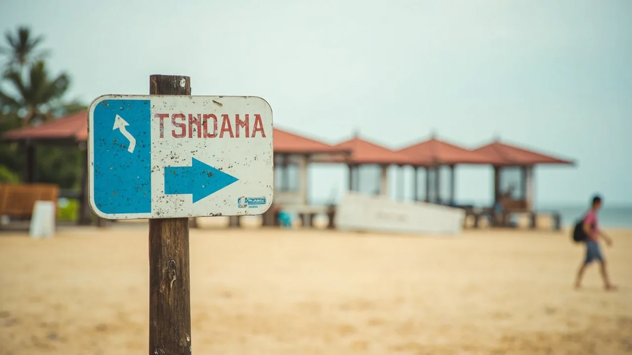
Indonesia Natural Disasters Guide 2026: Tsunamis & Safety
Indonesia is one of the most seismically active countries on earth, but the actual situation is calmer than the headlines. Most trips pass without incident because the country runs serious early-warning systems, the major hazards are seasonal, and basic preparation covers the rest. This guide covers the real risks, the official alert channels, and the one drill you need.
This is not a fear piece. Roughly 270 million people live in Indonesia through the same earthquakes, eruptions, and monsoon floods you are about to fly into. The locals are not panicking. You should not either, as long as you know which alerts to watch and what to do when your phone screams about a tsunami.
Quick Answers
| What | Answer | Price (INR) |
|---|---|---|
| Most likely disaster you will face | Flash flood or minor tremor during monsoon (Nov to March) | ₹0 (prevention is free) |
| Is there a working tsunami warning system? | Yes, BMKG sirens + SMS + the official InaTEWS app | ₹0 |
| Are volcanoes dangerous to tourists? | Some, but only a handful are at alert level 3 or 4 at any time | ₹0 |
| Do I need travel insurance that covers evacuation? | Yes, mandatory if you visit Mt. Merapi, Kelud, or any active crater zone | ~₹5,900/month |
| Should I cancel a Bali trip over earthquake news? | No, but learn the “drop, cover, hold” protocol before flying | ₹0 (free training) |
The Real Risks (Ranked by Likelihood for an Actual Tourist)
| Risk | Likelihood | Impact | How to Avoid |
|---|---|---|---|
| Monsoon flooding in Jakarta, Ubud, or Flores | High (Nov to March) | Moderate (street closures, landslides) | Avoid river-valley hotels in Jan/Feb; check bmkg.go.id daily |
| Strong earthquake felt while on the ground | High (Indonesia gets hundreds of detectable tremors annually, dozens felt by people) | Low to Severe | Know “drop, cover, hold”; do not run outside near glass |
| Tsunami after a major undersea quake | Low for tourists (beach zones have sirens) | Severe | Move 3 km inland or 30 m up within 10 minutes of sirens |
| Volcanic eruption affecting flights | Moderate (each year, somewhere) | Moderate to Severe | Check PVMBG level before hiking; follow airline updates |
| Volcanic lahar flows on Mt. Merapi, Semeru | Low for tourists (exclusion zones enforced) | Severe | Stay 4 km clear of alert-level 3 volcanoes, 6 km from level 4 |
| Landslides on Bali or Java highlands | Moderate in peak monsoon | Moderate | Avoid motorbike rides in heavy rain after dark |
| Wildfire / haze in Kalimantan or Sumatra | Seasonal (Aug to Oct) | Low to Moderate | Carry an N95 mask if flying to Pontianak or Palangkaraya |
The point of that table is not to scare you. It is to push “flooded Ubud guesthouse during Nyepi week” to the top of your mental list, because that is what 90% of actual Indian traveller incidents look like, and to push “tsunami while in Kuta” lower, because you would need a magnitude 8+ earthquake within 100 km of the coast, sirens to fail, and you to ignore them. Possible, vanishingly unlikely.
Prevention and Preparation (Before You Leave India)
Three layers of prep take care of almost everything: documents, insurance, and the apps on your phone. If you are planning a broader SE Asia trip, our Southeast Asia backpacking guide covers region-wide prep including disaster kits.
Documents and backups. Carry your passport, visa-on-arrival receipt (₹3,374 (~35 USD)), and Indian driving licence as both physical and digital copies. Bali arrivals also need to pay the IDR 150,000 tourism levy before landing. Upload them to a cloud folder you can open from any device, and WhatsApp the photo set to a parent or partner. Indonesia is a paper-trail society: police checks after even a minor scooter incident or a flood-evacuation centre will ask for ID. Our Bali emergency contacts guide has the exact Embassy of India helpline in Jakarta if you lose documents in a disaster zone.
Vaccines. Standard Indian traveller kit covers hepatitis A, typhoid, and tetanus. For disaster zones specifically, talk to your doctor about a tetanus booster if it has been more than 10 years, because floodwater cuts are how most post-flood infections start in tropical Asia. No “disaster-zone” specific vaccine is required.
Insurance. Pick a policy with three specific clauses: medical evacuation (helicopter from a volcano or remote island), trip interruption due to natural disaster, and emergency hotel if your accommodation floods or is structurally damaged. Most standard Indian policies exclude “act of God” and you only find out at claim time. SafetyWing’s Nomad Insurance covers all three and is a popular choice among Indian backpackers heading into Ring of Fire territory. More on this in the footer.
Apps and phones. Before you board the plane, download four things onto your primary phone, even if you plan to buy a local SIM on arrival:
- InaTEWS (BMKG tsunami early warning, English, free)
- Indonesia Geophysics Portal in browser (inatews.bmkg.go.id) for live earthquake maps
- MAGMA Indonesia (PVMBG volcano alert feed, free)
- Google Maps offline tiles for Bali, Yogyakarta, and Lombok
Treat alerts under M5.0 as background noise. Anything above M6.0 in coastal Indonesia is your cue to check the tsunami tab inside InaTEWS within five minutes.
Monsoon Season Hazards (November to March, and the Local Names)
The wet season is not a single block of bad weather. Indonesia runs two monsoon tracks: a western track through Sumatra and Java (heaviest Dec to Feb), and a southern track through Bali, NTB, and NTT (Nov to Mar, peaking January). Flood events cluster in January. Most flash floods in Ubud, Denpasar, and Bima have been in the Dec to Feb window, with a few outliers in March.
What happens on the ground: rivers swell, low-lying neighbourhoods (Kampung Bali in Jakarta, parts of Ubud centre, parts of Bima city) get one to three feet of water, drainage ditches overflow, landslides close the road over Mount Bromo or the Tumpang route to Mount Semeru. Scooter accidents increase notably during this window because visibility drops and roads stay slick.
Practical moves:
- Stay one street back from any river (the Tukad Badung in Ubud, the Code in Yogyakarta, the Ciliwung in central Jakarta)
- Book hotels above the second floor if you are in a known flood zone
- Do not ride a scooter in heavy rain after dark, particularly on Bali’s cliff roads south of Uluwatu
- If you are hiking Mt. Bromo, Mt. Ijen, or Mt. Semeru in the wet window, check the PVMBG level every morning and have a buffer day in your plan
For Bali-specific monsoon guidance, our places-to-avoid and Bali scooter rental safety articles cover street-level risk in detail.
What to Do When It Happens (Step by Step)
During an Earthquake (“Drop, Cover, Hold On”)
Indonesia’s building code for new hotels and malls is good. Older guesthouses and concrete mosques sometimes are not. The protocol is identical to Indian seismic drill protocol:
- Drop to your hands and knees before the shaking throws you down
- Cover your head and neck under a sturdy table or next to an interior wall (no doorways, that is a myth)
- Hold on until the shaking stops
- Do not run outside during the shake, falling debris kills more people than collapsing walls in Indonesian quakes
- Once it stops, if you are within 1 km of the coast, move inland immediately and to higher ground. Tsunamis can arrive within 10 minutes for the closest sources
If you are in a beach bar in Canggu when a long, sustained shake hits (more than 30 seconds), do not wait for the official siren. Head inland, take your passport and a power bank, and stop at 30 m above sea level or 3 km from shore, whichever comes first.
During a Tsunami Warning
Sirens wail, SMS blasts go out in Bahasa Indonesia, and InaTEWS goes red. The pattern in most Indonesian evacuations (Palu 2018 being the painful exception) is that people who treated the alert seriously survived. Steps:
- Stop arguing about whether it is “real”
- Grab phone, passport, water bottle
- Walk inland using the main road, do not drive (gridlock kills more than the wave does)
- Reach the designated vertical-evacuation shelter (most Indonesian cities have at least one; your hotel reception will know)
- Stay there until BMKG issues the all-clear, which can be 2 to 6 hours later
During a Volcanic Alert Upgrade
If PVMBG raises a volcano from level 2 (waspada) to level 3 (siaga) or 4 (awas):
- Level 3 = 4 km exclusion zone radius, no entry. Local authorities enforce this.
- Level 4 = 6 km exclusion zone, plus river-valley lahar danger. Eruptions are imminent or ongoing.
Most tourist routes are designed around this: Mt. Bromo is closed for weeks during level 3+ events, and Bali flights have been disrupted multiple times by Mt. Raung and Mt. Agung eruptions. Our Indonesia volcano safety guide covers the specific peaks travellers visit, the alert feed to watch, and what a flight cancellation refund policy looks like.
During a Flood
Jakarta floods, Ubud floods, and Bima floods all behave the same way: shallow flowing water for the first 24 hours, then contaminated standing water for days. See our drinking water safety guide for post-flood water precautions. If your hotel floods:
- Move everything electrical up by 12 hours before the water arrives
- Walk out via raised pavement, do not wade in moving floodwater (open manholes and snakes are real hazards)
- Keep wounds out of floodwater; if you cut yourself, wash with bottled water and apply iodine (Betadine is sold at every Guardian and Kimia Farma)
- Watch for dengue in the 2 to 4 weeks after a flood, mosquito populations spike. Our dengue and malaria guide covers symptoms and prevention
City-by-City Hazard Notes (Only the Tourist Spots That Matter)
Jakarta. Flood-prone from January to March, mainly central and north. Rare strong tremors, last damaging quake was the 2006 Pangandaran event. The Indian Embassy in Jakarta can issue emergency documents if the consulate office is itself flooded (it is in a flood-protected zone in Kuningan).
Yogyakarta. Mt. Merapi looms 30 km north. Stay out of the 4 km exclusion zone during any alert level 2+ period. The city itself is well-built to seismic code. Central Yogyakarta restaurants on higher ground away from the Code river valley are your safest bet during monsoon.
Bali. Earthquakes are frequent but small (most under M5.5, widely felt but rarely damaging). Tsunami risk is concentrated in south Bali (Kuta, Sanur, Nusa Dua) and fronted by a working siren system in Sanur and Kuta. The real Bali hazards are monsoon floods in Ubud, landslides on cliff roads south of Uluwatu, and rip currents at Kuta, Seminyak, and Padang Padang. Our Bali beach water safety guide covers the surf-and-rip risk in detail.
Labuan Bajo. Gateway to Komodo National Park. The flash-flood risk is real in January, including past events that have closed the airport. Restaurants on slightly raised ground near the harbour are your best bet when water rises. The main risk here besides floods is occasional seismic activity around the Sunda Islands arc, which can close Komodo boats for a day.
Lombok and the Gilis. Tremor-prone, including the damaging 2018 sequence. Ferry cancellations are common after M6+ events. Always book the Bali to Gili ferry with one buffer day before an international flight.
Getting Connected (Because Warnings Are SMS-Based)
You cannot rely on hotel WiFi during a real disaster, since power and backhaul both tend to fail. Buy a Telkomsel SIM on arrival in any airport (Xpander booths at Ngurah Rai DPS and Soekarno-Hatta CGK). A tourist SIM package runs ₹321-₹804 (~60,000-150,000 IDR or ~$3.75-$9.38) depending on data, which is the right tier for receiving BMKG SMS alerts and loading InaTEWS maps. If you cannot get a physical SIM on arrival or you want a fallback before you land, Get Nomad eSIM gives you Indonesian data from the moment you switch on the phone, useful for the first 24 hours when you are still figuring out where to buy the local SIM.
Indian-Specific Considerations
Indian travellers tend to deal with Indonesian disasters differently from regional tourists: the embassy network is good, but the on-the-ground signposting in Bahasa Indonesia can be hard to read. Three practical tips:
-
Save the Indian Embassy helpline before you fly. The Embassy of India in Jakarta is at Jl. Rasuna Said Kav. S-1, Kuningan, Jakarta. Emergency hotline: +62-21-520-4150. The Bali consulate (for the tourist zone specifically) is in Renon, Denpasar, +62-361-241-960. Both are equipped to issue emergency travel documents during disasters.
-
Carry Indian equivalents for the basics. Paracetamol (Sanmol or Panadol locally), ORS (most pharmacies stock it, but you can also bring your own), Pantocid (Protonix or Lanzoprazole), and Metrogyl (Flagyl) for severe diarrhoea. Local pharmacies (Apotek and Kimia Farma) are everywhere and cheap. Pharmacies will sell many things over the counter that require a prescription in India.
-
Veg/Indian food in the disaster window. Indian-run restaurants in Jakarta’s Kemayoran and central areas tend to be on raised ground and stay accessible during flood events. The Indiana Cuisine is another option. In Yogyakarta, the nearest fully-veg Indian spots are in Solo, so if you are stuck central during a flood alert, stock up from Indian grocery shops near Prawirotaman before the rains hit.
Hospital deposit if you need emergency care after an earthquake or flood: the typical upfront cash deposit at a private international clinic (Siloam, BIMC, Kasih Ibu) runs from ₹53,580-₹160,740 (~10,000,000-30,000,000 IDR or ~$625-$1,875), with the lower end for outpatient and the upper end for inpatient or surgery. Insurance direct-billing is honoured at BIMC and Siloam; everywhere else, pay upfront and claim.
FAQ
Is Indonesia safe to visit in 2026 despite the earthquake news?
Yes. Indonesia handles millions of tourists a year through active volcanoes, a moving crust, and a monsoon system. The country has functioning early-warning systems for both earthquakes and tsunamis. The risk is real but manageable, and most incidents reported in the press are in regions tourists never visit (Papua, the Banda Sea, North Sulawesi).
Do I need to download the InaTEWS app?
Yes, but only the official one from BMKG. There are several unofficial ones that send fake alerts for engagement. InaTEWS broadcasts actual tsunami warnings within 5 minutes of a qualifying earthquake. The app is free, under 20 MB, and works in English.
Should I cancel my Bali trip because of volcano news?
Almost never. Bali’s volcano (Mt. Agung, currently level 2) affects flights from Bali itself, not travellers going to Bali. Flights into DPS have been cancelled multiple times due to airborne ash, but that is an airport closure you can rebook around, not a ground risk. Check bali-airport.com for the current-day status before heading to the airport.
What is the safest region of Indonesia for a disaster-anxious first-timer?
Yogyakarta and Java’s central cities (Solo, Semarang) have the lowest combined flood + tsunami + volcano alert level among the popular spots. Bali has the most tourism infrastructure for disaster response. Lombok and the Gilis are mid-tier, the 2018 sequence caused real damage but recovery is complete.
How do I know if the safety alert is real and not a hoax?
Use the official channels only:
- BMKG: bmkg.go.id and the InaTEWS app
- BNPB (National Disaster Mitigation Agency): bnpb.go.id
- PVMBG (Volcanoes): pvmbg.esdm.go.id and the MAGMA app
- Indian MEA advisory for citizens: mea.gov.in
If you see an alert only on social media with no BMKG code, it is hearsay.
Subodh’s Take
Indonesia is not dangerous. Indonesia is just alive. The ground moves, the volcanoes smoke, the rain falls sideways for two months of the year, and the locals have built a system of sirens, SMS alerts, and 30-metre evacuation signs to make all of it survivable for the 270 million people who live here year-round. Your job as a visitor is shorter than theirs: download four apps, carry the right insurance, and learn the one drill (drop, cover, hold). Then go enjoy the nasi goreng.
- Subodh